Egypt Nubia Abyssinia Nile Delta Red Sea Cairo Alexandria c. 1856-72 Weller map
Brian DiMambro- Antiquarian Books, Maps & Prints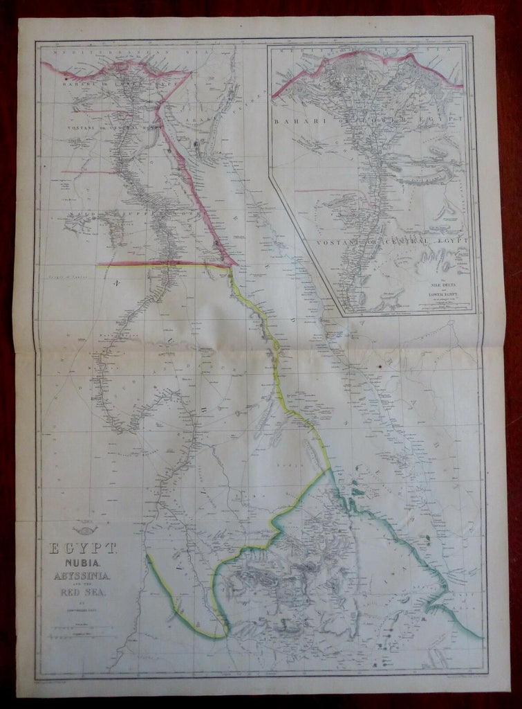
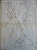
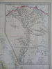
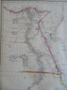
Egypt, Nubia, Abyssinia, and the Red Sea.
(Old Maps, 19th Century Maps, Africa, East Africa, North Africa, Egypt, Nubia, Abyssinia, Nile Delta, Cairo, Alexandria, Red Sea).
Issued c. 1856-72, London by Edward Weller for the Weekly Dispatch Atlas.
Mid 19th century lithographed map with original outline hand color.
A relatively uncommon map which was among maps issued in weekly installments for many years by this firm.
Typical signs of time and wear soft old crease lines which are easy to overlook.
Original center fold as issued.
Sheet Measures c. 25" H x 18 1/4" W.
Printed Area Measures c. 23 1/4" H x 17" W.
Cartographic Reference(s):
Tooley's Dictionary of Mapmakers, vol. 4.
[R30334].