Greek islands Aegean Turkey Rhodes Crete Dodecanese Lesbos 1683 Mallet map
Brian DiMambro- Antiquarian Books, Maps & Prints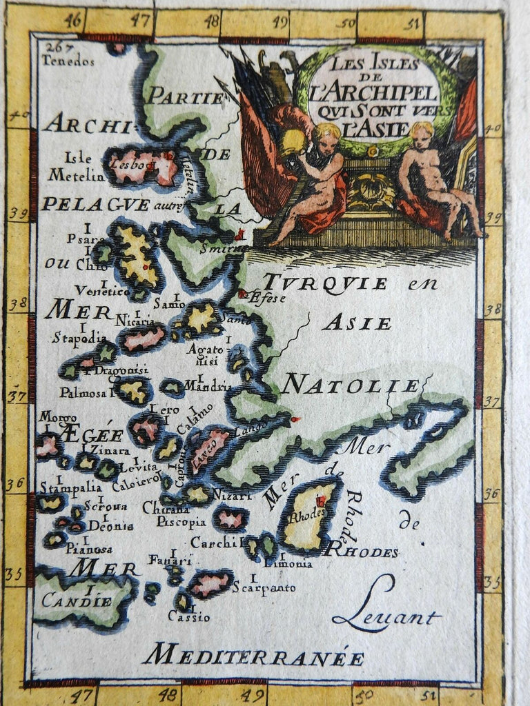
Les Isles de L'Archipel Qui Sont vers L'Asie.
(Ottoman Empire, Anatolia, Archipel, Rhodes, Crete, Aegean Sea, Aegean Islands).
Issued 1683, Paris, for A.M. Mallet.
Charming 17th century copper engraved map with lovely hand color.
Decorative cartouche at top right features seated nude figures with banners.
The image has a near folk-art feel, a style unique to this historical era. Utterly unlike anything produced today and of modern aesthetic appeal for this reason.
Mostly clean and well preserved example, the image displays a fine patina.
Sheet measures c. 7 7/8" H x 5 7/8" W.
Printed area measures c. 5 1/2" H x 4" W.
Cartographic Reference(s):
Tooley's Dictionary of Mapmakers, vol. 3, pp. 196.
[R23913].