Holy Roman Empire Westphalia Hanover c. 1796 Gibson early American miniature map
Brian DiMambro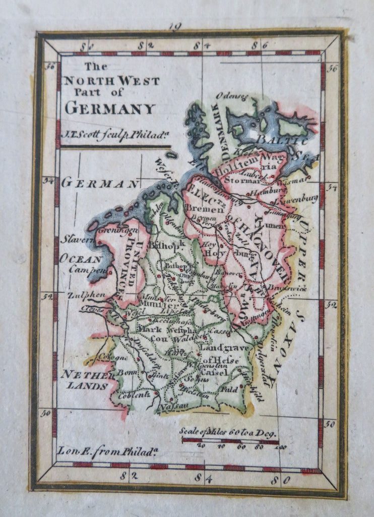
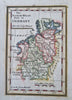
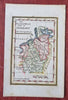
The North West Part of Germany.
(Old Prints, 18th Century Prints, Europe, Holy Roman Empire, Germany, Rhineland, Electorate of Hanover, Westphalia, Hesse-Cassel).
Issued c. 1796, Philadelphia by Gibson. Engraved by J. Scott.
Charming 18th century miniature map with lovely hand color. An wonderful example of map making from the early American republic.
Nice looking example, pleasing age patina, any minor age flaws easy to overlook or forgive.
Sheet Measures c. 5 1/4" H x 3 1/2" W.
Engraved Area Measures c. 3 7/8" H x 2 1/2" W.
Cartographic Reference(s):
Tooley's Dictionary of Mapmakers, vol. 4, pp 137.
Wheat & Brun, Maps Published in America Before 1800, 826.
[B12240].