Mainz Germany Holy Roman Empire Rhine River 1720's city plan map
Brian DiMambro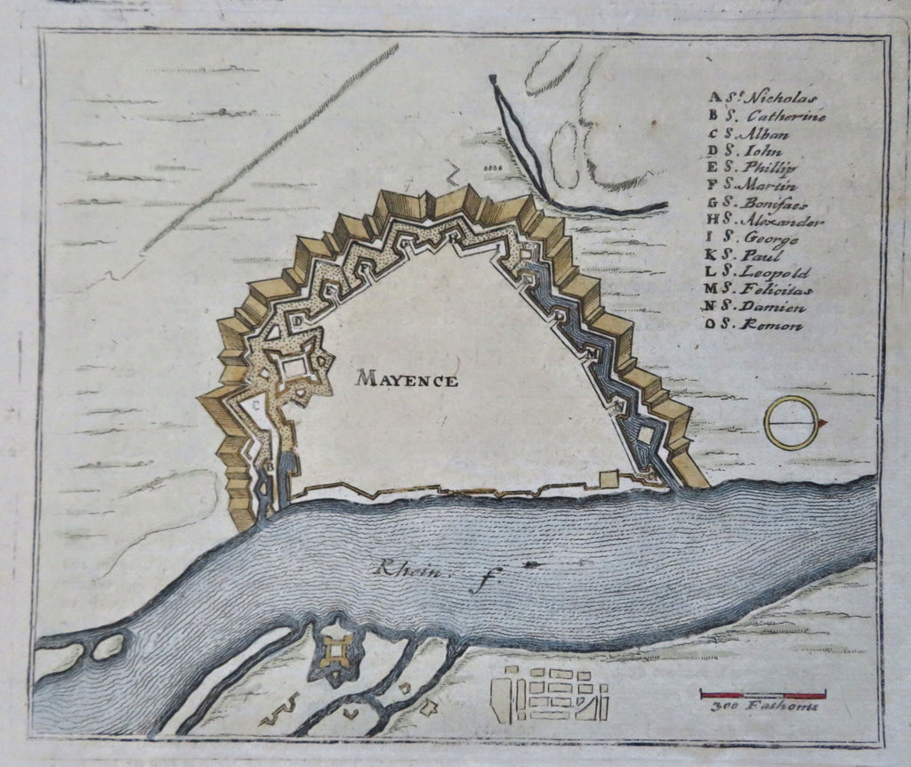
Mayence.
(Old Maps, 18th Century Maps, Europe, Holy Roman Empire, Germany, Mainz, City Plan, Military Fortifications, Rhine River).
Issued c. 1720, London.
Early 18th century engraved city plan with lovely hand color.
Nice looking example, pleasing age patina, any minor age flaws easy to overlook or forgive.
Sheet Measures c. 6 5/8" H x 7 3/4" W.
Engraved Area Measures c. 5 1/4" H x 7 1/4" W.
[B12326].