St. Helena Bay South Africa Western Cape 1748 harbor coastal survey Bellin map
Brian DiMambro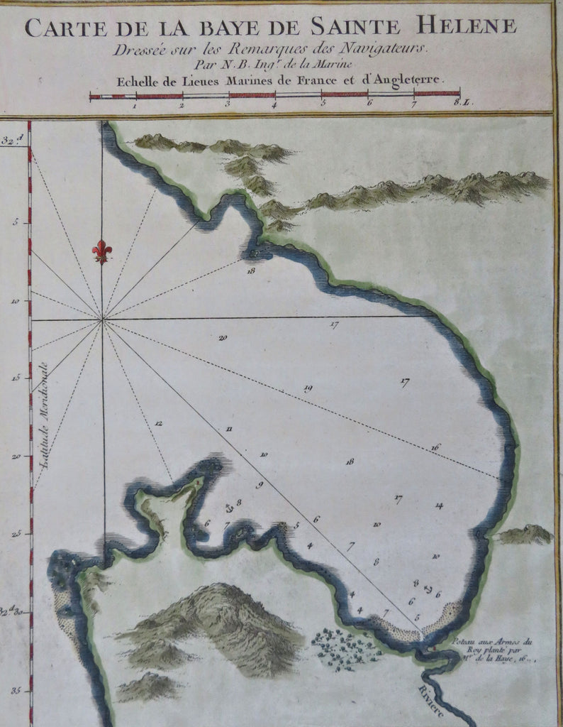
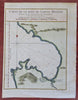
Carte de la Baye de Sainte Helene Dresse sur les Remarques des Navigatuers.
(Old Maps, 18th Century Maps, Africa, South Africa, Western Cape, St. Helena Bay).
Issued 1748, Paris by Bellin.
Mid 18th century engraved coastal chart with lovely hand color.
Nice looking example, pleasing age patina, any minor age flaws easy to overlook or forgive.
Sheet Measures c. 9 7/8" H x 7" W.
Engraved Area Measures c. 8 1/2" H x 6 1/2" W.
Cartographic Reference(s):
Tooley's Dictionary of Mapmakers, vol. 1.
[B12323].