Tahiti Society Islands French Polynesia 1774 engraved Exploration routes map
Brian DiMambro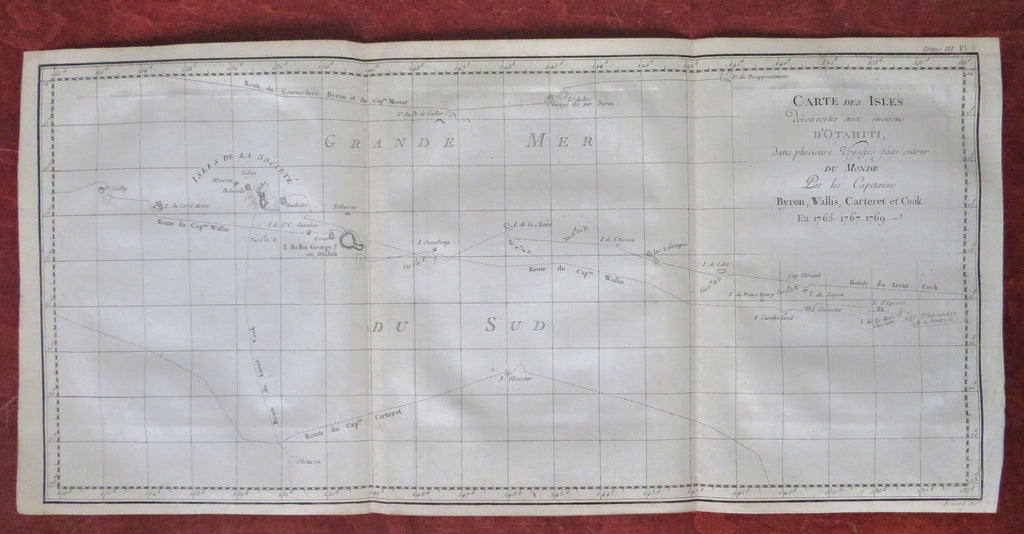
Carte des Isles Decouvertes aux Environs D'Otahiti san plusiers Voytages faits autour du Monde Par les Capitains Byron, Wallis, Carteret, et Cook en 1765, 1767, 1769.
(Old Maps, 18th Century Maps, Oceania, French Polynesia, Society Islands, Tahiti, Graphic Arts, Age of Exploration, Sailing Ships, World Voyages).
Issued 1774, Paris for Hawkesworth for the English Exploration of the Southern Hemisphere. Engraved by Benard.
A nice 18th century copper engraved print relating to the nautical exploration of the South Pacific.
Nice looking example, pleasing age patina, minor light staining, dustiness or toning, remains mostly clean, any minor age flaws easy to overlook or forgive.
Original fold lines as issued.
Sheet measures c. 10" H x 21" W.
Engraved area measures c. 9 1/2" H x 19 3/4" W.
[R33816].