Jamestown Expo Hampton Roads VA 1907 rare Fair booklet w/ 2 promotional maps
Brian DiMambro- Antiquarian Books, Maps & Prints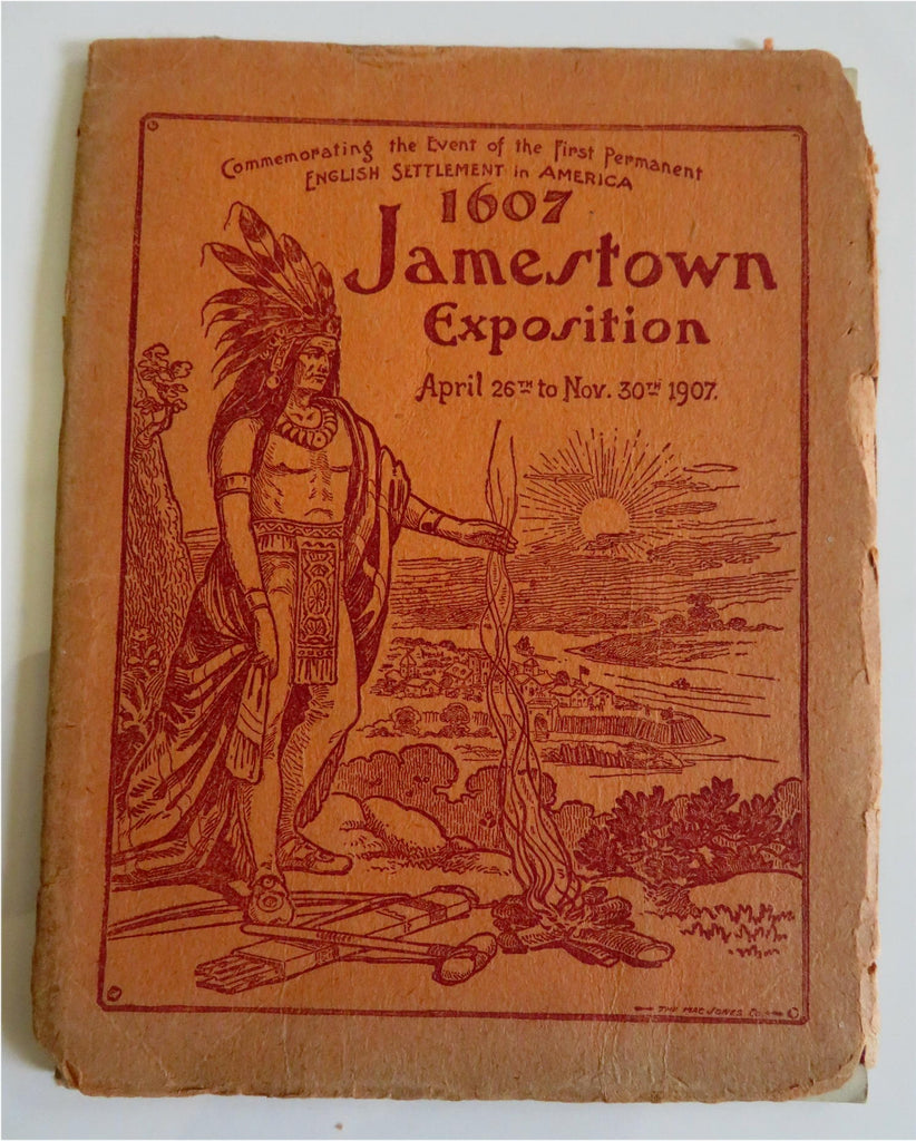


(Old Books, Early 20th Century Books, Americana, Virginia, Hampton Roads, Jamestown, Jamestown Exposition, Illustrated Books, Books with Maps).
1607 Jamestown Exposition April 26th to Nov. 30th 1907.
Published 1907, St. Louis, Missouri by Con. P. Curran Printing Co. for the Jamestown Exposition Company and their principal offices in Norfolk, Va.
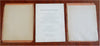
16 pages text, 2 color lithographed maps. Text in English. Illustrated throughout. Large folding maps at front & rear.
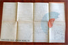
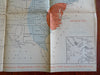
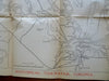
Rare ephemeral Exposition cartographic booklet with two large folding maps- one a transport map, the other a thematic population density map meant to promote the Fair to foreign countries.
A promotional pre-Fair solicitation item to attract ships and navies from countries and governments around the world.
Publisher's pictorial paper wrappers, yap edges with typical splits and chipping. Spine paper split, covers and maps cleanly detached.
Inherently fragile format thin saddle stitched pamphlet, rare in any condition.
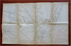
Two large folding maps affixed to covers. Both maps clean, paper is thin fairly acidified newsprint type, thus fragile, various old neat repairs to map intersections on versos (archival and unknown older tapes used).
Book is physically old and shows some signs of handling and time.
Binding age worn, edges toned with short chipping, mostly light or inoffensive signs of handling and time, book remains overall attractive as an object.
Paper is well age toned, still clean internally.
Still attractive on the shelf. The book displays a pleasing and unique age patina and is in overall nice antiquarian condition, any age flaws which may be present seem to us easy to overlook or forgive.
Please review photos for more detail showing how this book survives. The asking price reflects the condition based on our examination and 35+ years full time exposure to antiquarian books, maps and printed ephemera of all types and genres. Flaws seen and/ or described have been taken into account.
Historical Tidewater, Virginia map measures c. 20" W x 12 1/2" H. A transport map, overprinted in red to show RR mileages as well as Domestic & foreign Steamship lines.
map #2- Population near Hampton Roads, Va. overprinted in two colors to reflect population density. Thematic map.
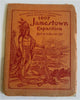
Booklet Measures c. 7" H x 5 1/2" W.
[B8741].