Catholic Netherlands Artois Flanders Liege Luxemburg 1702 Delisle antique map
Brian DiMambro- Antiquarian Books, Maps & Prints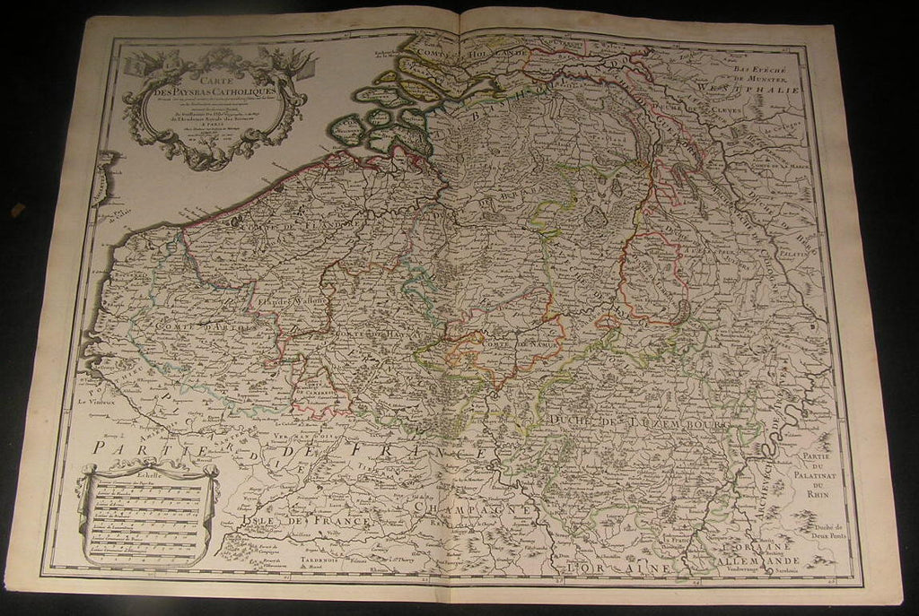
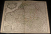
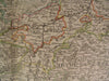
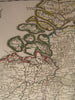
Carte des Paysbas Catholiques
(Low Countries)
Issued ca. 1702, Paris by De L'Isle
Fine and uncommon old map of Belgium, Netherlands, Luxemburg, and Flanders. With original outline hand color.
Fine large strapwork cartouche at top left features two mythological figures, sleeping lion, flags, garland, etc. Large distance scale at bottom left.
A picture is worth a thousand words. The photos are a major part of the item description. Please examine them closely, as what you see is what we will send you.
[note: we grade conservatively and always seek to disclose any noteworthy flaws.].
Map remains well preserved, clean and very attractive. Some light age wear or surface spotting/ soiling which is visible within the scan, top margin spotted with a bit of minor light dampstaining at top of the centerfold (easy to miss or overlook).
Paper and image remains overall clean & sound. Old maps & prints often display small minor repairs on the back, could have uneven blank margins, might have extraneous fold-lines or other small minor age flaws which do not detract from the visual appeal or value. Condition is carefully considered in arriving at our price.
Great antique map entirely worthy of hanging for display.
A depiction captured in a manner entirely unique to this era.
Sheet measures c. 19 7/8" H x 26 5/8" W.
Printed area measures c. 18 3/8" H x 24 1/4" W
Original fold line as issued.
Tooleys Dictionary of Mapmakers , v. 1, p.354*
[R1628]