Gibraltar Spain England Town city fortifications c.1740 Basire engraved war map
Brian DiMambro- Antiquarian Books, Maps & Prints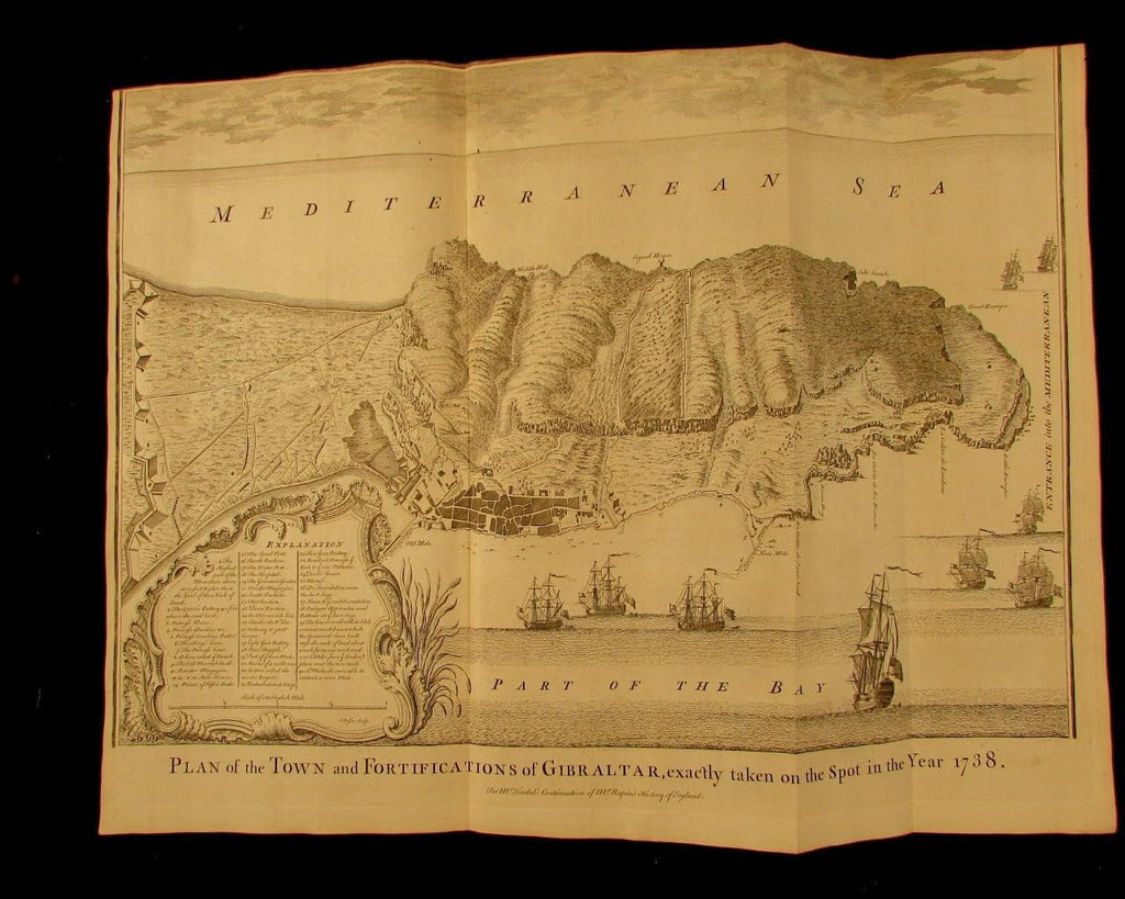


Plan of the Town and Fortifications of Gibraltar, exactly taken on the spot in the year 1738
(Spain- Gibraltar- England-)
Issued c.1730-40, London for Tinal
Engraved by J. Basire
Fine, appealing and uncommon old engraved folio sheet panoramic birds-eye view map. Wonderful large detailed vignette cartouche at bottom left shows contains a long list in three columns of 40 specific buildings, details and features shown. Numerous tall mast sailing war ships with their national ensigns fluttering in the wind approach the harbor area from the Mediterranean Sea across the top.
With original vertical fold lines, top blank margin trimmed down long ago just into the engraved area at top right. Still attractive and eminently frameable.
As originally issued long ago, an actual antique/ vintage printed sheet of paper, not a modern copy or reprint. The paper sheet could show various minor signs of age, but if we are offering it for sale, you can be 100% certain it is entirely worthy of ownership by even the most discerning collector or dealer.
A picture is worth a thousand words. The scan is a major part of the item description. Please examine it closely, as what you see is what we will send you.
[note: we grade conservatively and always seek to disclose any noteworthy flaws.].
Sheet remains well preserved, keeping in mind it is not modern or new, so minor flaws to paper unworthy of specific mention are sometimes to be expected. Some light age wear or surface spotting/ soiling, all of which is hopefully visible within the zoomable scan.
Paper and image remains overall clean & sound. Old maps & prints often display small minor repairs on the back, could have uneven blank margins, might have extraneous fold-lines or other small minor age flaws which do not detract from the visual appeal or value. Condition is carefully considered in arriving at our price.
Great old vintage antique map entirely worthy of hanging for display.
A cartographic depiction captured in a manner entirely unique to this era.
Sheet measures c. 15 1/4" H x 23 3/4" W.
Printed area measures c. 13 1/2" H x 22 1/2" W
[R7029]