Holland Germany Flanders Zeeland 1788 folio Grussefeld scarce antique folio map
Brian DiMambro- Antiquarian Books, Maps & Prints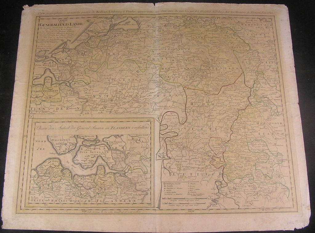
Charte uber die Generalitaets Lande,
oder diejenigen Antheile, welche die General Staaten der Vereinigten Niederlande
an den Herzogthumern Brabant, Limburg und der Graschaft Flandern besizen
Entworsen und nach dem Pariser Frieden
vom Jahr 1785 in Ansehung der Grezen
(Holland / Netherlands / Germany / France)
Issued Germany, c. 1788 by Gussefeld chez Homann Heirs.
Fascinating, uncommon and well-preserved late 18th century engraved folio sheet map.
With original outline hand color.
Depicts Northern Europe including Holland, Flanders, Zeeland & eastern Germany, etc.
Very detailed, countless place names, roads, rivers, mountains and other landmarks identified. With inset of Flanders including a large portion of Zeeland Holland at bottom left. Includes the cities of Breda, Goes, Axel, Antwerp, Leeuwe, Heusden, Venlo, Bergen op Zoom, etc.
In Good+, mostly clean condition. Sheet uniformly age toned and slightly browned. Map displays short edge-splits, minor cedge chipping and marginal soiling, couple short marginal tears repaired with tape long ago on verso.
Otherwise map remains clean, and still entirely desirable and presentable overall, centerfold is slightly lighter than rest of map.
An uncommon 18th century folio sheet map.
Sheet measures c. 25" W x 21" H.
Engraved area c. 22 1/2" W x 18 1/4" H.
Folio.
Original fold line as issued.
R614