Languedoc Southern France w/ city views plan insets 1708 rare de la Feuille map
Brian DiMambro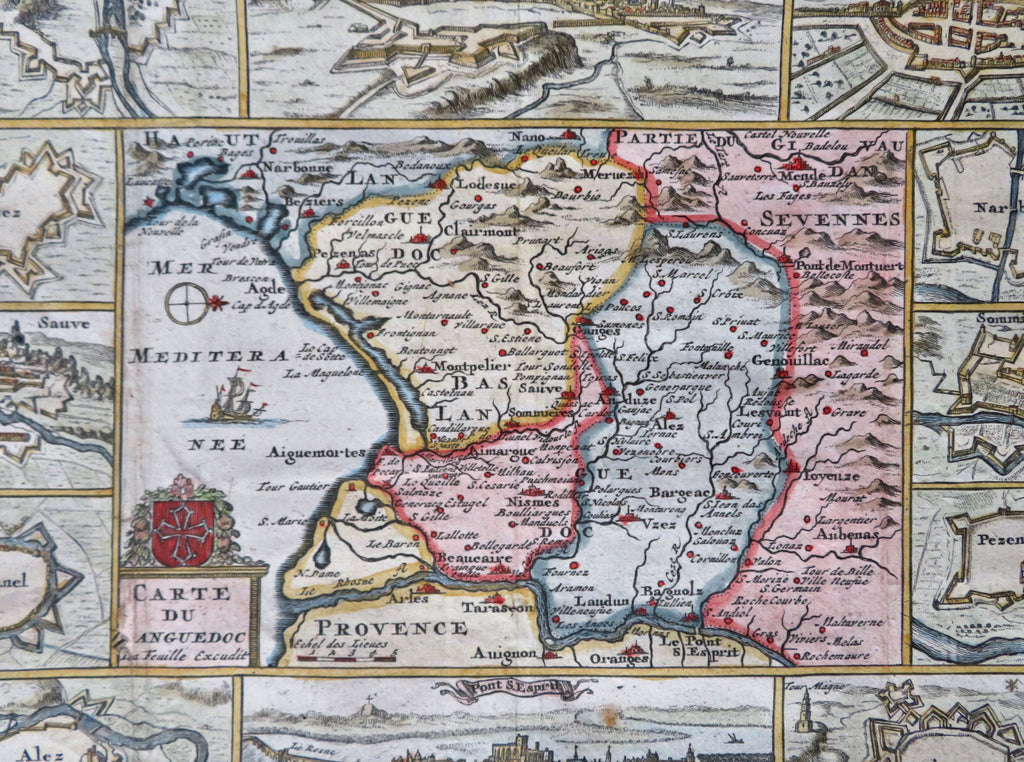
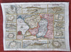
Carte Nouvelle de Languedoc.
(Old Maps, 18th Century Maps, Europe, France, Languedoc, Montpelier, Narbonne, Alez, Anduze).
Issued 1708, Amsterdam by de La Feuille.
Scarce early 18th century engraved map with attractive hand color. Superior visual example, a great decorative map surrounded with plans of fortified cities and four prospect birds-eye views.
Remains a nice looking example with a pleasing age patina. Any age flaws mostly minor and easy to overlook or forgive.
Original fold lines as issued, map was neatly affixed long ago to an old paper backing sheet.
Sheet Measures c. 7 3/4" H x 10 1/4" W.
Engraved Area Measures c. 6 1/4" H x 8 1/2" W.
Cartographic Reference(s):
Tooley's Dictionary of Mapmakers, vol. 1.
[R32216].