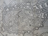
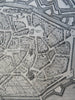
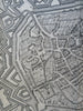
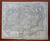
Mons Hainaut Belgium c. 1745 Basire pictorial city plan churches fortifications
Brian DiMambro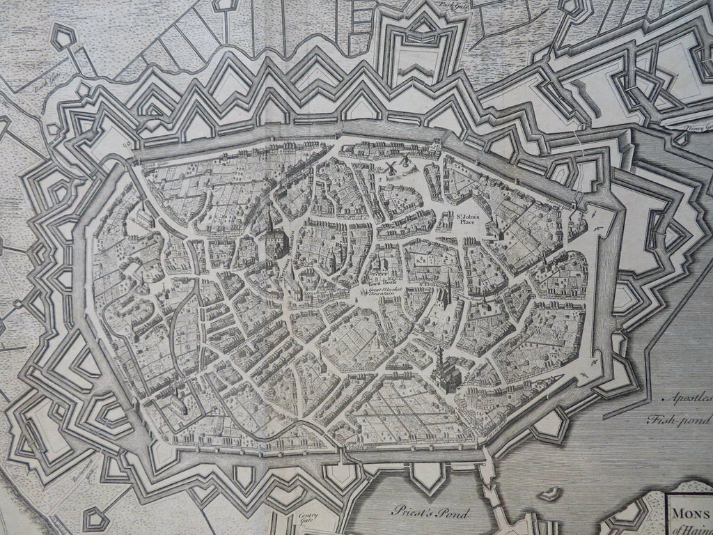
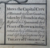

Mons, The Capital City of Hainault in the Low Countries, Taken by ye French in 1691, Restored to ye Spaniards by ye Peace of Ryswick in 1697, Retaken by the Allies in 1709 and Left to Ye Emperor by Ye Treaty of Utrecht.
(Old Maps, 18th Century Maps, Europe, Belgium, Hainaut, Mons, Military Fortifications, Star Fort, City Plan).
Issued c. 1745 London by Tindall. Engraved by J. Basire.
Mid 18th century detailed engraved city plan. Rendered in a prospect three dimensional manner with endless intricate garden plans and street scapes.
Nice looking example, pleasing age patina, any minor age flaws easy to overlook or forgive.
Original fold lines as issued.
Sheet measures c. 16" H x 19 1/2" W.
Engraved area measures c. 14 1/4" H x 18 1/2" W.
Cartographic Reference(s):.
Tooley's Dictionary of Mapmakers, vol. 1.
[R31428].