Aire City Plan Fort St. Francis St. Venant Belgium c1745 antique Basire map
Brian DiMambro -Historical Investments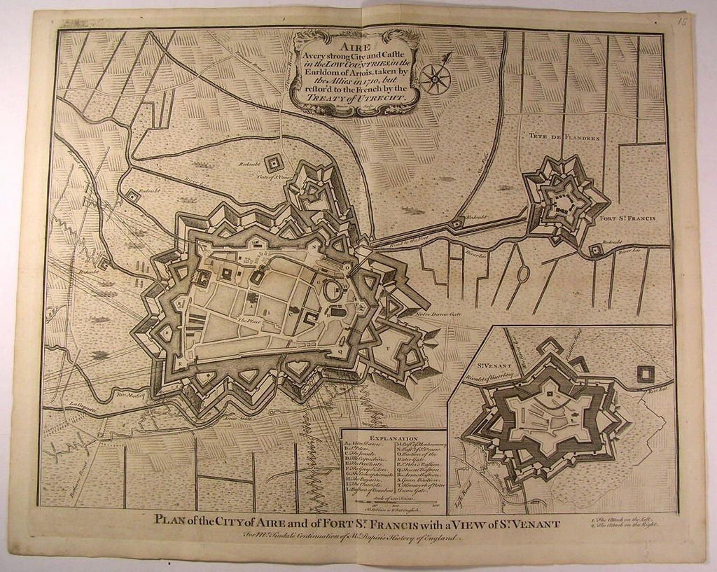
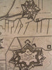
Plan of the City of Aire and of Fort St. Francis with a View of St. Venant
A very strong City and Castle in the Low Countries, in the Earldom of Artois, taken by the Allies in 1710, but restor'd to the French by the Treaty of Utrecht
(Europe- Belgium- European History- Military Map)
For Mr. Tindal's Continuation of Mr. Rapin's History of England
Printed ca. 1735-45, London
Engraved by Basire
Original antique folio sheet engraved
map. Very detailed, showing topography, troop locations, place names, and a fine large strapwork title cartouche.
A detailed, scarce and interesting battle map which could readily be collected on it's own merits, displayed or given as a present.
In Fair to Good antiquarian condition, mostly clean overall, light minor age dustiness or light surface wear, small scattered spotting or age soiling as seen, original fold-lines as issued, some extra fold-lines which are easy to overlook or forgive visually, couple minor blank margin repairs to tiny holes, overall the map is clean and very attractive -- map has been priced according to this pleasing but not perfect condition as described.
Please inspect photos closely- any noteworthy flaws to the printed surface area should be noticeable within pictures provided. These pictures form a central part of the item description and we encourage you to study them carefully. We will send the actual antique item shown.
[ note: We grade very conservatively. We are doing our best to show & describe this item so you are happy when it arrives ].
An interesting antique printed map that any collector, dealer, institution or person of taste would be happy to own or display.
Sheet measures c. 20 5/8" W x 16 5/8" H.
Engraved area measures c. 19" W x 15 3/8" H.
[R4691]
Tooleys Dictionary of Mapmakers , v. 1, p. 94