French colonies West Africa Senegal Saint-Louis Porto Novo c.1890 old Bayle map
AntiqueMapsPrints.com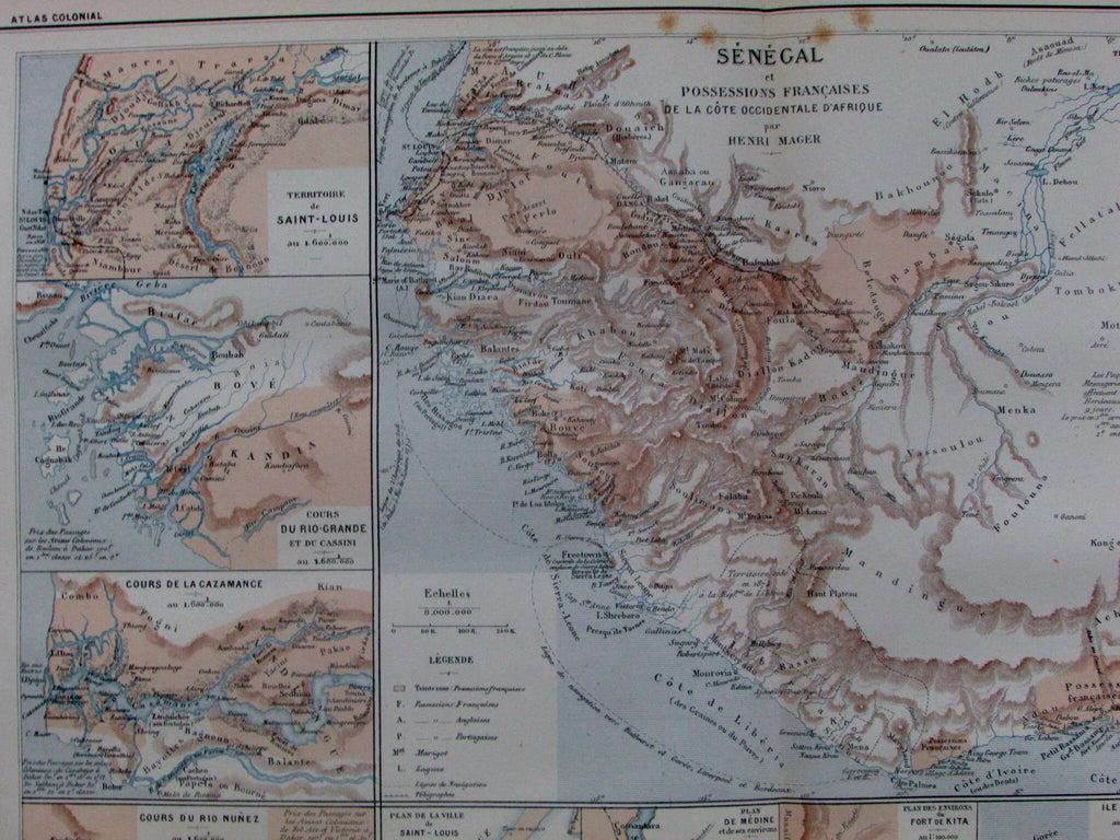

Senegal et Possessions Francaises
De La Cote Occidentale D'Afrique
par Henri Mager
(French Colonies in West Africa)
Issued Paris, c.1885-90 by Bayle.
Engraved by A. Simon.
Detailed and uncommon late 19th century color lithographed map, focusing on these former French colonies.
Series of 12 inset maps include: Saint-Louis, Fort Kita, Goree Island, Proto Novo, etc.
Minor light toning and small scattered age spotting as typical for maps of this vintage, but to our eyes and for most people, an entirely acceptable and nice looking example of this antique map.
Original fold line as issued.
Sheet measures c. 19 1/2" x 12 3/4".
Printed area measures c. 16 1/4" x 11".
Small oblong folio format.
Tooley's Dictionary of Mapmakers , vol. 4, p. 163.
[R13415]