Greece Peloponnese Peninsula Candia Sea 1843 antique Teesdale hand color map
Brian DiMambro -Historical Investments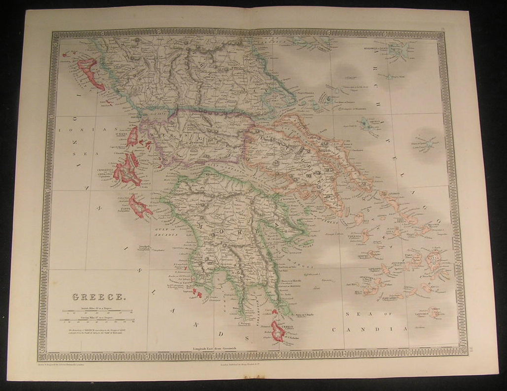
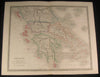
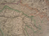
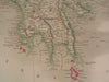
Greece
(Morea, Greek Archipelago, Zante, Isthmus of Corinth, Gulf of Argos)
Issued 1843, London, by Henry Teesdale & co.
Engraved by J. Dower
Fine and uncommon old engraved map with attractive original outline hand color.
A picture is worth a thousand words. The photos are a major part of the item description. Please examine them closely, as what you see is what we will send you.
[note: we grade conservatively and always seek to disclose any noteworthy flaws.].
Map remains well preserved. Some light age wear or surface spotting/ soiling which is visible within the scan.
Paper and image remains overall clean & sound. Old maps & prints often display small minor repairs on the back, could have uneven blank margins, might have extraneous fold-lines or other small minor age flaws which do not detract from the visual appeal or value. Condition is carefully considered in arriving at our price.
Great antique map entirely worthy of hanging for display.
A depiction captured in a manner entirely unique to this era.
Original fold line as issued.
Sheet measures c. 15" H x 18 3/4" W.
Printed area measures c. 13 3/8" H x 16 3/8" W
Tooleys
Dictionary of Mapmakers
, v. 4, p. 256
[R2116]