London England City Plan Great Britain 1849 Meyer scarce lovely antique map
Brian DiMambro -Historical Investments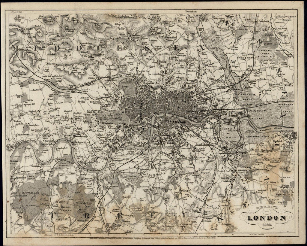
Gegend von London
(United Kingdom- Great Britain- England- Area of London- City Plan)
Published 1849, Hildburghausen, Germany by Meyer for the
Grosser Zeitungs Hand-Atlas
Finely detailed antique engraved German
map.
A detailed and uncommon mid-19th century German map which could readily be collected on it's own merits, displayed or given as a present.
Nice looking map, in Fair to Good antiquarian condition, mostly clean overall, centerfold as issued, light minor age dustiness or small scattered age spotting as seen, sheet toned as seen in scan, normal age toning & wear, overall the map remains visually attractive. Paper is ca. 170 years old, signs of age, not new or perfect, if you like genuine old paper items with minor flaws and imperfections, you will like this item. If you are seeking perfect and like new, this is not the item for you.
Please inspect photos closely- any noteworthy flaws to the printed surface area should be noticeable within pictures provided. These pictures form a central part of the item description and we encourage you to study them carefully. We will send the actual antique item shown.
[ note: We grade very conservatively. We are doing our best to show & describe this item so you are happy when it arrives ].
An interesting antique printed map that any collector, dealer, institution or person of taste would be happy to own or display.
Sheet measures c. 11 1/2" W x 9 1/4" H.
Engraved area measures c. 11 1/8" W x 8 3/4" H.
[R5562]
Espenhorst,
Bibliographie der Handatlanten
, 3.3.2. (p.159)
Tooleys
Dictionary of Mapmakers
, v. 3, p. 245