Moon surface topography mountains craters 1873 old antique German chart map
AntiqueMapsPrints.com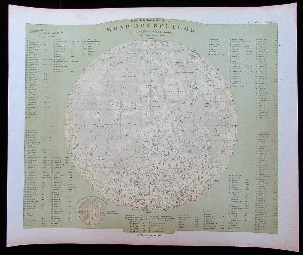

Die sichtbare Seite der Mond-Oberflache bei voller Beleuchtung nach Beer und Madler's Karte.
(Topography of the surface of the Moon)
Issued Gotha, Germany, 1873 by Stieler.
Lovely antique color lithographed celestial chart.
Among the most detailed celestial maps of the Moon surface issued in the mid-19th century which are still readily available in the market place.
In near VG or better condition, minor light surface age wear and toning as typical, some faint minor foxing in the blank margins, overall the image is clean, well preserved and very attractive.
Sheet measures c. 18 1/4" x 15 1/4"
Printed area measures c. 16" x 14"
Folio.
[R11262]