North West Africa Senegal early exploration overland routes c1862 Meyer old map
AntiqueMapsPrints.com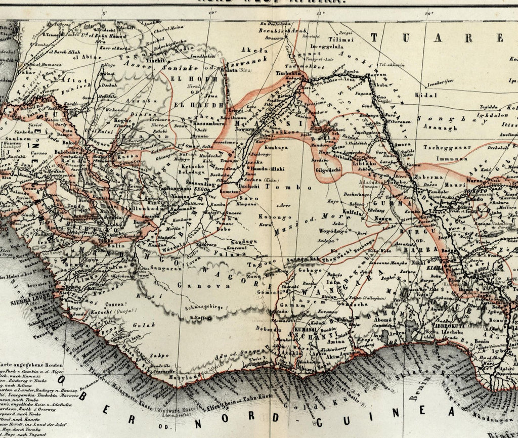
Nord-West-Afrika
(Northwest coast Africa / Guinea / Senegal / Sierra Leone- Gold- Slave- Ivory)
Issued Hildburghausen, Germany c. 1862 by Meyer.
Uncommon small-format mid-19th century color-lithographed map. Overprinted in red to correspond to key bottom left corner. Distance scale given in 6 diff. Colonial mileages.
Key at bottom left identifies 16 different specific exploration expedition routes dating from 1805-60.
Sheet is gently uniformly age toned but otherwsie clean and well preserved, just trivial edge spotting or toning.
Original fold line as issued.
Sheet measures c. 11 1/2" x 9 1/4"
Engraved area measures c. 10 1/2" x 8".
[R12997]
Espenhorst,
Bibliographie der Handatlanten
, 3.5.1 (p. 192)
Tooleys
Dictionary of Mapmakers
, v. 3, p. 245