Turkey Archipelago Mediterranean Sea 1683 charming miniature antique map view
Brian DiMambro -Historical Investments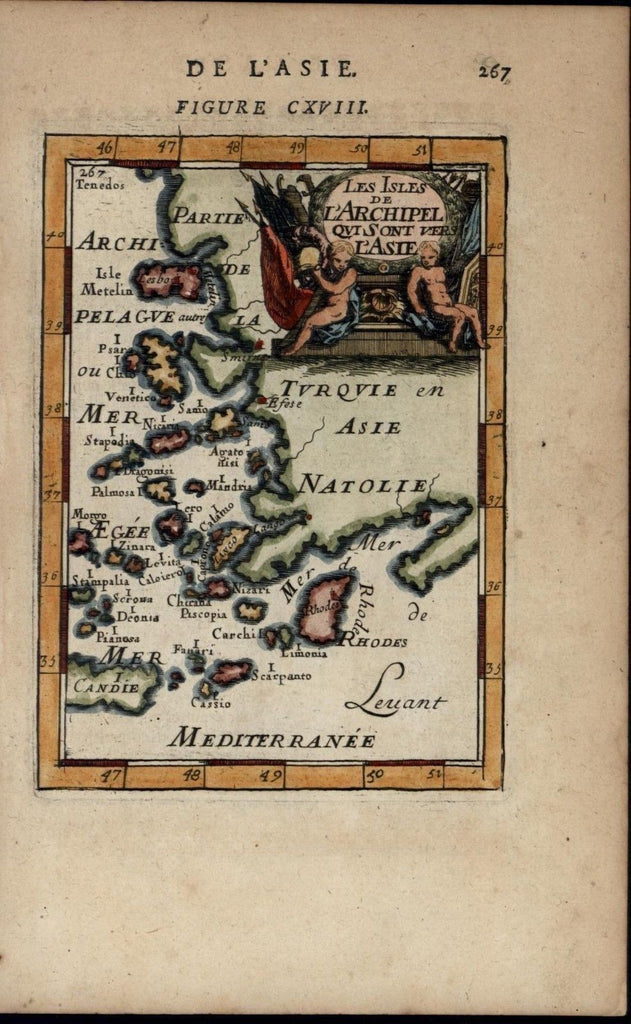
De L'Asie
Figure CXVIII
Les Isles De L'Archipel Qvi Sont Vers L'Asie
(Archipellago of Turkey, Mediterranean Sea, Rhodes)
(Mallet map)
Issued 1683, Paris for A. M. Mallet
Delightful little antique engraved map. Executed in 17th century Europe with an artistic charm quite unique to this era and well pleasing to the modern eye.
A map not often encountered with such appealing hand-color (recent) and overall visual appeal. Originally issued virtually only ever in b&w, an example carefully hand colored in such an excellent and professional manner as this is not easily found.
Distinguished by it's most pleasing period charm when examined in person.
Printed on nice hand-made period paper as issued, sheet retains its inherent structural flexibility and soundness.
Topographical descriptive text on reverse, as issued & always. Extracted from a rare late-17th century geography compendium which had this map (as well as a profusion of similarly appealing world-wide maps & views) prepared specifically for it.
In close to VG [or better] condition: displays minor light age toning as typical, trivial scattered small spotting and some light toning to the edge of the sheet; overall the map remains clean and very attractive. If you have seen Mallet 1683 maps before, you will recognize that this is a good one--- please inspect visual scan closely and note the zoom feature which allows for close inspection [note: we grade very conservatively and always seek to disclose any noteworthy flaws].
A cartographic depiction captured in a manner entirely unique to this method & era.
Any minor defects along the sheet edges and in the margins may be seen in the photos.
Sheet measures c. 5 3/8" W x 8 1/2" H.
Printed area measures c. 4" W x 5 1/2" H.
[70746]